
Make a donation
Gear up for your next adventure:
As an Amazon Associate, this site earns from qualifying purchases at no extra cost to you.
Las Médulas topographic map
Click on the map to display elevation.
Make a donation
Gear up for your next adventure:
As an Amazon Associate, this site earns from qualifying purchases at no extra cost to you.
Las Médulas
The spectacular landscape of Las Médulas resulted from the ruina montium (wrecking of the mountains), a Roman mining technique described by Pliny the Elder in 77 AD. The technique employed was a type of hydraulic mining which involved undermining a mountain with large quantities of water. The water was supplied by interbasin transfer. At least seven long aqueducts tapped the streams of the La Cabrera district (where the rainfall in the mountains is relatively high) at a range of altitudes. The same aqueducts were used to wash the extensive alluvial gold deposits.
Make a donation
Gear up for your next adventure:
As an Amazon Associate, this site earns from qualifying purchases at no extra cost to you.
About this map
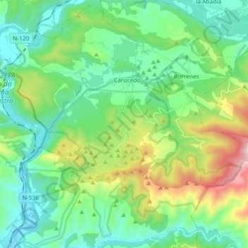
Name: Las Médulas topographic map, elevation, terrain.
Average elevation: 2,070 ft
Minimum elevation: 1,184 ft
Maximum elevation: 4,610 ft
Make a donation
Gear up for your next adventure:
As an Amazon Associate, this site earns from qualifying purchases at no extra cost to you.