
Mali topographic map
Interactive map
Click on the map to display elevation.
About this map
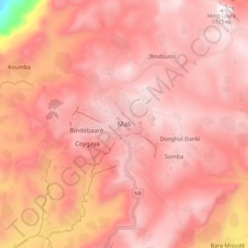
Name: Mali topographic map, elevation, terrain.
Location: Mali, Mali Prefecture, Labé Region, Guinea (12.03552 -12.33569 12.11552 -12.25569)
Average elevation: 4,304 ft
Minimum elevation: 1,854 ft
Maximum elevation: 5,013 ft
Other topographic maps
Click on a map to view its topography, its elevation and its terrain.
Kerouane
Guinea > Labé Region > Mali Prefecture
Kerouane, Mali Prefecture, Labé Region, Guinea
Average elevation: 1,490 ft