
Fonte Cerreto topographic map
Interactive map
Click on the map to display elevation.
About this map
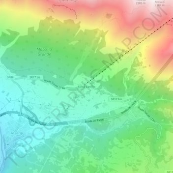
Name: Fonte Cerreto topographic map, elevation, terrain.
Location: Fonte Cerreto, L'Aquila, Abruzzes, Italie (42.40601 13.50911 42.44601 13.54911)
Average elevation: 4,360 ft
Minimum elevation: 2,667 ft
Maximum elevation: 7,546 ft
Other topographic maps
Click on a map to view its topography, its elevation and its terrain.