
绥阳县 topographic map
Interactive map
Click on the map to display elevation.
About this map
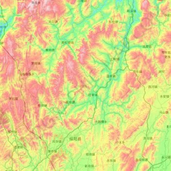
Name: 绥阳县 topographic map, elevation, terrain.
Location: 绥阳县, 遵义市, 贵州省, 中国 (27.82224 106.96194 28.49028 107.52727)
Average elevation: 3,497 ft
Minimum elevation: 1,745 ft
Maximum elevation: 6,158 ft
Other topographic maps
Click on a map to view its topography, its elevation and its terrain.