
Embarthe topographic map
Interactive map
Click on the map to display elevation.
About this map
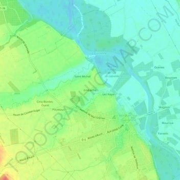
Name: Embarthe topographic map, elevation, terrain.
Average elevation: 344 ft
Minimum elevation: 282 ft
Maximum elevation: 463 ft
Other topographic maps
Click on a map to view its topography, its elevation and its terrain.
Magasin
France > Occitanie > Tarn-et-Garonne > Verdun-sur-Garonne
Magasin, Verdun-sur-Garonne, Montauban, Tarn-et-Garonne, Occitanie, France métropolitaine, 82600, France
Average elevation: 335 ft
Les Najats
France > Occitanie > Tarn-et-Garonne > Verdun-sur-Garonne
Les Najats, Verdun-sur-Garonne, Montauban, Tarn-et-Garonne, Occitanie, France métropolitaine, 82600, France
Average elevation: 338 ft