
Thank you for supporting this site ❤️
Make a donation
Make a donation
Gear up for your next adventure:
As an Amazon Associate, this site earns from qualifying purchases at no extra cost to you.
6713 topographic map
Click on the map to display elevation.
Thank you for supporting this site ❤️
Make a donation
Make a donation
Gear up for your next adventure:
As an Amazon Associate, this site earns from qualifying purchases at no extra cost to you.
About this map
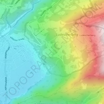
Name: 6713 topographic map, elevation, terrain.
Location: 6713, Gemeinde Ludesch, Bezirk Bludenz, Vorarlberg, Oostenrijk (47.19381 9.79542 47.19391 9.79552)
Average elevation: 2,621 ft
Minimum elevation: 1,745 ft
Maximum elevation: 4,327 ft
Thank you for supporting this site ❤️
Make a donation
Make a donation
Gear up for your next adventure:
As an Amazon Associate, this site earns from qualifying purchases at no extra cost to you.