
Ballaigues topographic map
Interactive map
Click on the map to display elevation.
About this map
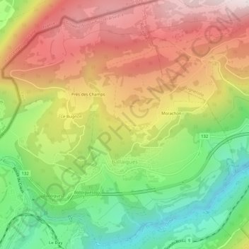
Name: Ballaigues topographic map, elevation, terrain.
Location: Ballaigues, District du Jura-Nord vaudois, Vaud, 1338, Suisse (46.71868 6.38514 46.75269 6.43599)
Average elevation: 3,136 ft
Minimum elevation: 1,985 ft
Maximum elevation: 4,321 ft