
团田乡 topographic map
Interactive map
Click on the map to display elevation.
About this map
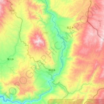
Name: 团田乡 topographic map, elevation, terrain.
Location: 团田乡, 腾冲市, 保山市, 云南省, 中国 (24.62636 98.57051 24.80341 98.67354)
Average elevation: 5,069 ft
Minimum elevation: 3,255 ft
Maximum elevation: 7,080 ft