
Steep topographic map
Interactive map
Click on the map to display elevation.
About this map
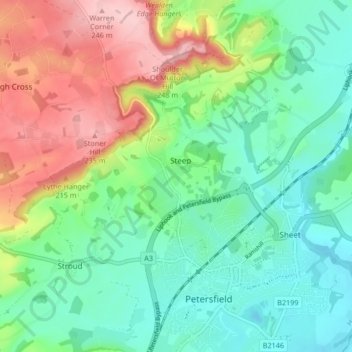
Name: Steep topographic map, elevation, terrain.
Location: Steep, East Hampshire, Hampshire, Angleterre, Royaume-Uni (51.00079 -0.97695 51.04070 -0.89336)
Average elevation: 377 ft
Minimum elevation: 148 ft
Maximum elevation: 830 ft
Other topographic maps
Click on a map to view its topography, its elevation and its terrain.
Goatacre
Royaume-Uni > Angleterre > Hampshire > East Hampshire > Medstead
Goatacre, Medstead, East Hampshire, Hampshire, Angleterre, GU34 5NA, Royaume-Uni
Average elevation: 587 ft
Bentworth
Royaume-Uni > Angleterre > Hampshire > East Hampshire
Bentworth, East Hampshire, Hampshire, Angleterre, Royaume-Uni
Average elevation: 554 ft