
Thank you for supporting this site ❤️
Make a donation
Make a donation
Gear up for your next adventure:
As an Amazon Associate, this site earns from qualifying purchases at no extra cost to you.
Vannes topographic map
Click on the map to display elevation.
Thank you for supporting this site ❤️
Make a donation
Make a donation
Gear up for your next adventure:
As an Amazon Associate, this site earns from qualifying purchases at no extra cost to you.
About this map
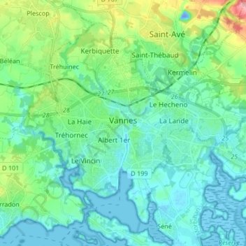
Name: Vannes topographic map, elevation, terrain.
Location: Vannes, Morbihan, Brittany, Metropolitan France, 56000, France (47.62085 -2.81555 47.69456 -2.68166)
Average elevation: 79 ft
Minimum elevation: -75 ft
Maximum elevation: 384 ft
Thank you for supporting this site ❤️
Make a donation
Make a donation
Gear up for your next adventure:
As an Amazon Associate, this site earns from qualifying purchases at no extra cost to you.