
Orro topographic map
Interactive map
Click on the map to display elevation.
About this map
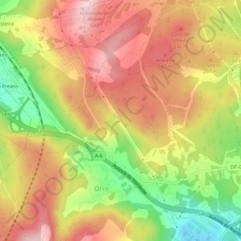
Name: Orro topographic map, elevation, terrain.
Location: Orro, Culleredo, A Coruña, Galicia, España (43.27307 -8.44674 43.30123 -8.40625)
Average elevation: 564 ft
Minimum elevation: 135 ft
Maximum elevation: 886 ft
Other topographic maps
Click on a map to view its topography, its elevation and its terrain.