Geolocate

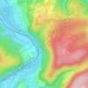
Sachsenhausen topographic map

Click on the map to display elevation.

About this map

Name: Sachsenhausen topographic map, elevation, terrain.

Location: Sachsenhausen, Waldeck, Landkreis Waldeck-Frankenberg, Hesse, 34513, Germany (51.21475 8.96723 51.26462 9.04669)

Average elevation: 1,184 ft

Minimum elevation: 827 ft

Maximum elevation: 1,552 ft

Other topographic maps

Click on a map to view its topography, its elevation and its terrain.
Hagenstein

Germany > Hesse > Landkreis Waldeck-Frankenberg

Average elevation: 1,138 ft

Gear up for your next adventure:

🚁Photography Drones - Capture stunning aerial views of landforms and topography
🛶Inflatable Kayak - Portable kayak for rivers, lakes, and expeditions
🔦Compact Flashlight - Reliable flashlight for emergencies
🎒Gear Packing Cubes - Organize your backpack efficiently
🔭Stargazing Telescopes - Perfect for camping in low-light pollution areas shown on maps

As an Amazon Associate, this site earns from qualifying purchases at no extra cost to you.