
Saint-Louis topographic map
Interactive map
Click on the map to display elevation.
About this map
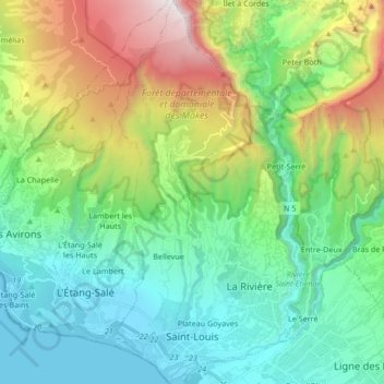
Name: Saint-Louis topographic map, elevation, terrain.
Location: Saint-Louis, Saint-Pierre, La Réunion, France (-21.30332 55.38041 -21.14702 55.46445)
Average elevation: 2,372 ft
Minimum elevation: 0 ft
Maximum elevation: 8,389 ft