Geolocate

Redgrave topographic map

Click on the map to display elevation.

About this map

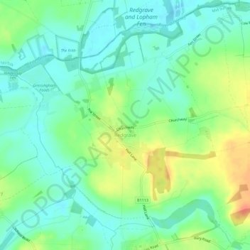
Name: Redgrave topographic map, elevation, terrain.

Location: Redgrave, Mid Suffolk, Suffolk, England, United Kingdom (52.34542 0.98029 52.37861 1.03598)

Average elevation: 118 ft

Minimum elevation: 69 ft

Maximum elevation: 207 ft

Gear up for your next adventure:

🩹Survival Bandages - High‑quality bandages for emergencies
🦺Reflective Outdoor Gear - Safety gear for low‑light conditions
📷Action Cameras - Rugged cameras to document your journeys across rugged terrain
🗃️Trail First Aid Kit - Essential kit for outdoor injuries and emergencies
🦶Hiking Gaiters - Keep debris and water out of your boots

As an Amazon Associate, this site earns from qualifying purchases at no extra cost to you.