
Lensk topographic map
Interactive map
Click on the map to display elevation.
About this map
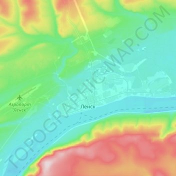
Name: Lensk topographic map, elevation, terrain.
Average elevation: 833 ft
Minimum elevation: 476 ft
Maximum elevation: 1,847 ft
Other topographic maps
Click on a map to view its topography, its elevation and its terrain.
Batamaj
Russia > Sakha Republic > Lensky Ulus
Batamaj, Салдыкельский наслег, Lensky Ulus, Sakha Republic, Far Eastern Federal District, Russia
Average elevation: 623 ft