
Diamond Peak topographic map
Interactive map
Click on the map to display elevation.
About this map
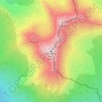
Name: Diamond Peak topographic map, elevation, terrain.
Average elevation: 7,431 ft
Minimum elevation: 6,122 ft
Maximum elevation: 8,701 ft
Other topographic maps
Click on a map to view its topography, its elevation and its terrain.
Crook County
United States of America > Oregon
Crook County, Oregon, United States of America
Average elevation: 4,393 ft
Medford
United States of America > Oregon > Medford
Medford, Jackson County, Oregon, United States of America
Average elevation: 1,447 ft
Beaverton
United States of America > Oregon > Beaverton
Beaverton, Washington County, Oregon, United States of America
Average elevation: 348 ft