
Cajay topographic map
Interactive map
Click on the map to display elevation.
About this map
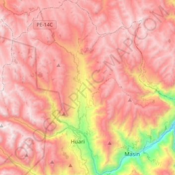
Name: Cajay topographic map, elevation, terrain.
Location: Cajay, Provincia de Huari, Áncash, Perú (-9.39386 -77.20831 -9.15499 -77.01232)
Average elevation: 12,992 ft
Minimum elevation: 7,946 ft
Maximum elevation: 15,761 ft
Other topographic maps
Click on a map to view its topography, its elevation and its terrain.
Laguna Chequiacocha
Laguna Chequiacocha, Cajay, Huari, Áncash, Perú
Average elevation: 14,354 ft