
Punaauia topographic map
Interactive map
Click on the map to display elevation.
About this map
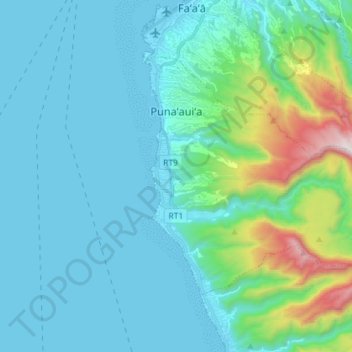
Name: Punaauia topographic map, elevation, terrain.
Location: Punaauia, Îles du Vent, Polynésie française, France (-17.66443 -149.62041 -17.57160 -149.47684)
Average elevation: 705 ft
Minimum elevation: -3 ft
Maximum elevation: 4,554 ft