
Thank you for supporting this site ❤️
Make a donation
Make a donation
Gear up for your next adventure:
As an Amazon Associate, this site earns from qualifying purchases at no extra cost to you.
Neerijse topographic map
Click on the map to display elevation.
Thank you for supporting this site ❤️
Make a donation
Make a donation
Gear up for your next adventure:
As an Amazon Associate, this site earns from qualifying purchases at no extra cost to you.
About this map
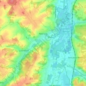
Name: Neerijse topographic map, elevation, terrain.
Location: Neerijse, Huldenberg, Leuven, Flemish Brabant, Flanders, Belgium (50.78721 4.58475 50.83512 4.64624)
Average elevation: 177 ft
Minimum elevation: 69 ft
Maximum elevation: 351 ft
Thank you for supporting this site ❤️
Make a donation
Make a donation
Gear up for your next adventure:
As an Amazon Associate, this site earns from qualifying purchases at no extra cost to you.