Ganderbal topographic map
Interactive map
Click on the map to display elevation.
About this map
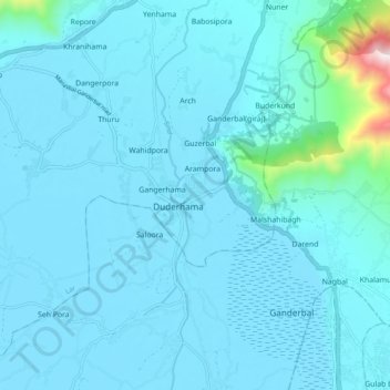
Name: Ganderbal topographic map, elevation, terrain.
Average elevation: 5,407 ft
Minimum elevation: 5,180 ft
Maximum elevation: 8,392 ft

Click on the map to display elevation.
Name: Ganderbal topographic map, elevation, terrain.
Average elevation: 5,407 ft
Minimum elevation: 5,180 ft
Maximum elevation: 8,392 ft