Geolocate
👉 Easily get elevation data in JSON, GeoTIFF and KML formats using Elevation API
Thank you for supporting this site ❤️
Make a donation

Sumgayit topographic map

Click on the map to display elevation.

About this map

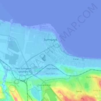
Name: Sumgayit topographic map, elevation, terrain.

Location: Sumgayit, Sumqayit, Absheron-Khizi, Azerbaijan (40.54410 49.56494 40.62177 49.72241)

Average elevation: -23 ft

Minimum elevation: -98 ft

Maximum elevation: 266 ft

Gear up for your next adventure:

🧤Tactile Hiking Gloves - Keep hands warm while operating GPS and smartphone screens
🔭Stargazing Telescopes - Perfect for camping in low-light pollution areas shown on maps
👖Convertible Hiking Pants - Versatile zip-off pants for changing altitudes and temperatures
🛡️Bear Spray Outdoor - Protection in bear country hikes
🪶Multi‑Purpose Knife - Useful blade for camp and trail

As an Amazon Associate, this site earns from qualifying purchases at no extra cost to you.