
Unterbach topographic map
Interactive map
Click on the map to display elevation.
About this map
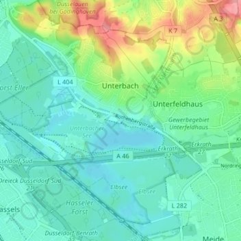
Name: Unterbach topographic map, elevation, terrain.
Average elevation: 187 ft
Minimum elevation: 112 ft
Maximum elevation: 394 ft
Other topographic maps
Click on a map to view its topography, its elevation and its terrain.
Düsseldorf
Allemagne > Rhénanie-du-Nord-Westphalie > Düsseldorf
Düsseldorf, Regierungsbezirk Düsseldorf, Rhénanie-du-Nord-Westphalie, 40213, Allemagne
Average elevation: 207 ft