
Villamaría topographic map
Interactive map
Click on the map to display elevation.
About this map
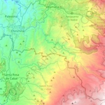
Name: Villamaría topographic map, elevation, terrain.
Location: Villamaría, Centrosur, Caldas, Colombia (4.80251 -75.58937 5.05226 -75.31738)
Average elevation: 7,884 ft
Minimum elevation: 3,478 ft
Maximum elevation: 15,699 ft