
Port Sudan topographic map
Interactive map
Click on the map to display elevation.
About this map
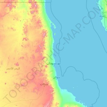
Name: Port Sudan topographic map, elevation, terrain.
Location: Port Sudan, Red Sea State, 79800, Sudan (19.00979 33.25248 21.12145 37.55506)
Average elevation: 958 ft
Minimum elevation: -10 ft
Maximum elevation: 6,978 ft
Other topographic maps
Click on a map to view its topography, its elevation and its terrain.
Halayeb Distrikt
Halayeb Distrikt, Red Sea State, Sudan
Average elevation: 1,289 ft
Jabal Gumbiri
Sudan > Red Sea State > Sinkat District
Jabal Gumbiri, Sinkat District, Red Sea State, Sudan
Average elevation: 3,799 ft
Port Sudan
Sudan > Red Sea State > Port Sudan
Port Sudan, Red Sea State, 79800, Sudan
Average elevation: 164 ft