Geolocate

Frederiksberg topographic map

Click on the map to display elevation.

About this map
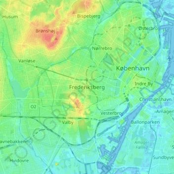
Name: Frederiksberg topographic map, elevation, terrain.

Location: Frederiksberg, Frederiksberg Municipality, Capital Region of Denmark, 1861, Denmark (55.63802 12.49262 55.71802 12.57262)

Average elevation: 36 ft

Minimum elevation: -13 ft

Maximum elevation: 128 ft

Other topographic maps

Click on a map to view its topography, its elevation and its terrain.
Gear up for your next adventure:

🗃️Trail First Aid Kit - Essential kit for outdoor injuries and emergencies
🔥Camping Stove - Portable stove for camping and backcountry cooking
👟Men's Trail Runners - Lightweight footwear for fast-paced exploration and light hiking
🧴Hand Sanitizer - Keep hands clean while hiking
🎒Trekking Poles - Sturdy poles for balance and stability on rough terrain

As an Amazon Associate, this site earns from qualifying purchases at no extra cost to you.