
Baïssescure topographic map
Interactive map
Click on the map to display elevation.
About this map
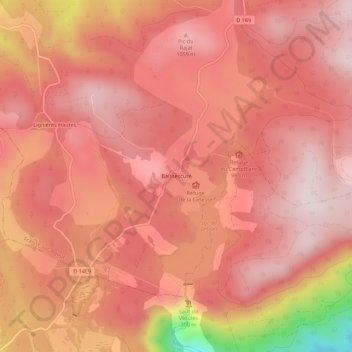
Name: Baïssescure topographic map, elevation, terrain.
Average elevation: 3,182 ft
Minimum elevation: 1,873 ft
Maximum elevation: 3,619 ft
Other topographic maps
Click on a map to view its topography, its elevation and its terrain.
Coustorgues
France > Occitanie > Hérault > Fraisse-sur-Agout
Coustorgues, Fraisse-sur-Agout, Béziers, Hérault, Occitanie, France métropolitaine, 34330, France
Average elevation: 2,589 ft