
Alamüdün topographic map
Interactive map
Click on the map to display elevation.
About this map
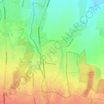
Name: Alamüdün topographic map, elevation, terrain.
Location: Alamüdün, Alamüdün District, Chuy Region, 724303, Kyrgyzstan (42.89015 74.61665 42.93015 74.65665)
Average elevation: 2,310 ft
Minimum elevation: 2,215 ft
Maximum elevation: 2,405 ft
Other topographic maps
Click on a map to view its topography, its elevation and its terrain.
Alamedin
Kyrgyzstan > Chuy Region > Alamudun District
Alamedin, Alamudun District, Chuy Region, 724303, Kyrgyzstan
Average elevation: 2,287 ft