
Thank you for supporting this site ❤️
Make a donation
Make a donation
Gear up for your next adventure:
As an Amazon Associate, this site earns from qualifying purchases at no extra cost to you.
Fatih Mahallesi topographic map
Click on the map to display elevation.
Thank you for supporting this site ❤️
Make a donation
Make a donation
Gear up for your next adventure:
As an Amazon Associate, this site earns from qualifying purchases at no extra cost to you.
About this map
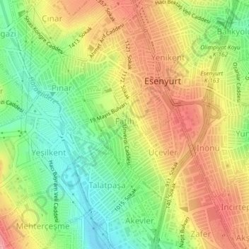
Name: Fatih Mahallesi topographic map, elevation, terrain.
Location: Fatih Mahallesi, Esenyurt, Istanbul, Marmara Region, Turkey (41.02477 28.66678 41.03428 28.68199)
Average elevation: 295 ft
Minimum elevation: 102 ft
Maximum elevation: 495 ft
Thank you for supporting this site ❤️
Make a donation
Make a donation
Gear up for your next adventure:
As an Amazon Associate, this site earns from qualifying purchases at no extra cost to you.
Other topographic maps
Click on a map to view its topography, its elevation and its terrain.