
西乡县 topographic map
Interactive map
Click on the map to display elevation.
About this map
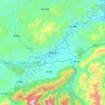
Name: 西乡县 topographic map, elevation, terrain.
Location: 西乡县, 汉中市, 陕西省, 中国 (32.83245 107.59896 33.15245 107.91896)
Average elevation: 2,402 ft
Minimum elevation: 1,309 ft
Maximum elevation: 7,005 ft
Other topographic maps
Click on a map to view its topography, its elevation and its terrain.