
Bukit Barisan Selatan National Park topographic map
Interactive map
Click on the map to display elevation.
About this map
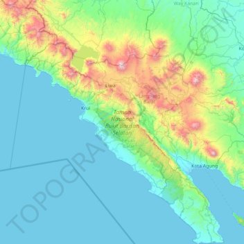
Name: Bukit Barisan Selatan National Park topographic map, elevation, terrain.
Average elevation: 951 ft
Minimum elevation: 0 ft
Maximum elevation: 6,909 ft