
Golfar topographic map
Interactive map
Click on the map to display elevation.
About this map
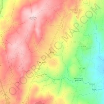
Name: Golfar topographic map, elevation, terrain.
Location: Golfar, Moreira de Rei, Trancoso, Guarda, 6420-153, Portugal (40.79469 -7.35366 40.83469 -7.31366)
Average elevation: 2,500 ft
Minimum elevation: 1,850 ft
Maximum elevation: 2,982 ft