
St. Joseph topographic map
Interactive map
Click on the map to display elevation.
About this map
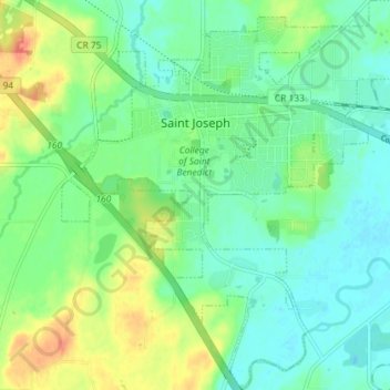
Name: St. Joseph topographic map, elevation, terrain.
Location: St. Joseph, Stearns County, Minnesota, United States (45.52981 -94.34281 45.58023 -94.27561)
Average elevation: 1,102 ft
Minimum elevation: 1,047 ft
Maximum elevation: 1,211 ft
Other topographic maps
Click on a map to view its topography, its elevation and its terrain.
Greenwald
United States > Minnesota > Stearns County
Greenwald, Stearns County, Minnesota, 56335, United States
Average elevation: 1,266 ft
Eden Valley
United States > Minnesota > Stearns County
Eden Valley, Stearns County, Minnesota, United States
Average elevation: 1,135 ft
St. Cloud
United States > Minnesota > Stearns County > St. Cloud
St. Cloud, Stearns County, Minnesota, United States
Average elevation: 1,047 ft
Paynesville
United States > Minnesota > Stearns County
Paynesville, Stearns County, Minnesota, United States
Average elevation: 1,184 ft