
Sierra los Indios topographic map
Interactive map
Click on the map to display elevation.
About this map
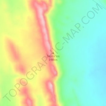
Name: Sierra los Indios topographic map, elevation, terrain.
Location: Sierra los Indios, Ahumada, Chihuahua, México (30.11028 -106.08595 30.11038 -106.08585)
Average elevation: 4,948 ft
Minimum elevation: 4,682 ft
Maximum elevation: 5,322 ft
Other topographic maps
Click on a map to view its topography, its elevation and its terrain.