
Argveta topographic map
Interactive map
Click on the map to display elevation.
About this map
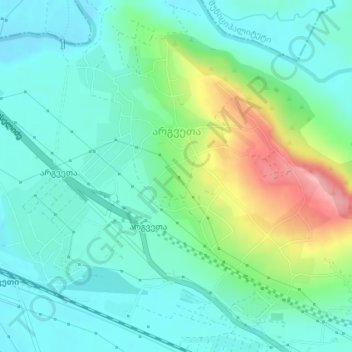
Name: Argveta topographic map, elevation, terrain.
Location: Argveta, Zestaponi Municipality, Imereti, Georgia (42.13018 42.96571 42.15200 43.00070)
Average elevation: 541 ft
Minimum elevation: 427 ft
Maximum elevation: 856 ft
Other topographic maps
Click on a map to view its topography, its elevation and its terrain.
Achara
Georgia > Imereti > Zestaponi Municipality
Achara, Zestaponi Municipality, Imereti, Georgia
Average elevation: 1,211 ft