
Hoeksche Waard topographic map
Interactive map
Click on the map to display elevation.
About this map
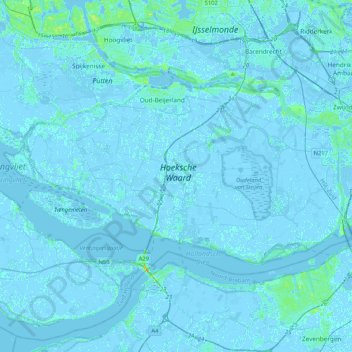
Name: Hoeksche Waard topographic map, elevation, terrain.
Location: Hoeksche Waard, Zuid-Holland, Nederland (51.69247 4.21325 51.83705 4.63163)
Average elevation: 0 ft
Minimum elevation: -16 ft
Maximum elevation: 66 ft
Other topographic maps
Click on a map to view its topography, its elevation and its terrain.
Zuidzijde
Nederland > Zuid-Holland > Hoeksche Waard > Zuidzijde
Zuidzijde, Hoeksche Waard, Zuid-Holland, Nederland, 3264, Nederland
Average elevation: 0 ft