
Lorentz National Park topographic map
Interactive map
Click on the map to display elevation.
About this map
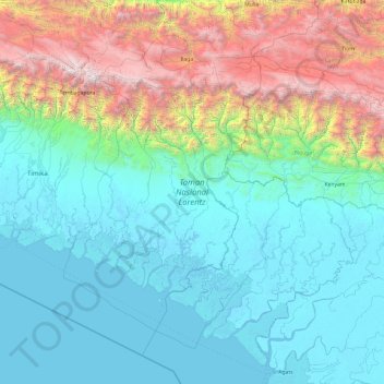
Name: Lorentz National Park topographic map, elevation, terrain.
Average elevation: 3,120 ft
Minimum elevation: -16 ft
Maximum elevation: 15,646 ft
Other topographic maps
Click on a map to view its topography, its elevation and its terrain.
Jet River
Indonesia > South Papua > Asmat
Jet River, Asmat, South Papua, Indonesia
Average elevation: 10 ft