
San Antonio Zaragoza topographic map
Interactive map
Click on the map to display elevation.
About this map
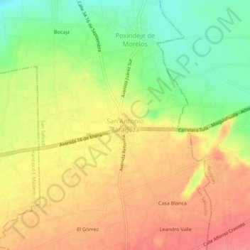
Name: San Antonio Zaragoza topographic map, elevation, terrain.
Location: San Antonio Zaragoza, San Salvador, Hidalgo, México (20.23498 -99.01833 20.27498 -98.97833)
Average elevation: 6,506 ft
Minimum elevation: 6,378 ft
Maximum elevation: 6,601 ft
Other topographic maps
Click on a map to view its topography, its elevation and its terrain.
Déxtho de Victoria
México > Hidalgo > San Salvador > Déxtho de Victoria
Déxtho de Victoria, San Salvador, Hidalgo, 42646, México
Average elevation: 6,401 ft
San Salvador
México > Hidalgo > San Salvador
San Salvador, Hidalgo, 42646, México
Average elevation: 6,795 ft