
Nyköping topographic map
Interactive map
Click on the map to display elevation.
About this map
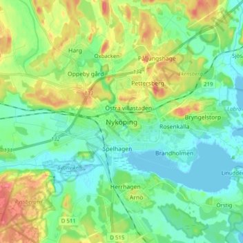
Name: Nyköping topographic map, elevation, terrain.
Average elevation: 62 ft
Minimum elevation: -7 ft
Maximum elevation: 187 ft
Other topographic maps
Click on a map to view its topography, its elevation and its terrain.
Hall
Hall, Flens kommun, Södermanland County, 649 91, Sweden
Average elevation: 118 ft
Katrineholm
Katrineholm, Katrineholms kommun, Södermanland County, 641 46, Sweden
Average elevation: 157 ft
Eskilstuna
Eskilstuna, Eskilstuna kommun, Södermanland County, 632 27, Sweden
Average elevation: 89 ft