
Pocitos topographic map
Interactive map
Click on the map to display elevation.
About this map
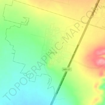
Name: Pocitos topographic map, elevation, terrain.
Location: Pocitos, Matehuala, San Luis Potosí, México (23.74630 -100.61325 23.78630 -100.57325)
Average elevation: 5,387 ft
Minimum elevation: 5,223 ft
Maximum elevation: 5,600 ft
Other topographic maps
Click on a map to view its topography, its elevation and its terrain.
Matehuala
México > San Luis Potosí > Matehuala
Matehuala, San Luis Potosí, 78722, México
Average elevation: 5,755 ft