
Vellore topographic map
Interactive map
Click on the map to display elevation.
About this map
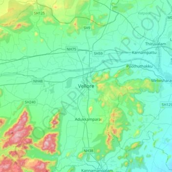
Name: Vellore topographic map, elevation, terrain.
Location: Vellore, Vellore district, Tamil Nadu, 632002, India (12.74718 78.97097 13.06718 79.29097)
Average elevation: 928 ft
Minimum elevation: 502 ft
Maximum elevation: 2,894 ft