
马衙街道 topographic map
Interactive map
Click on the map to display elevation.
About this map
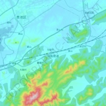
Name: 马衙街道 topographic map, elevation, terrain.
Location: 马衙街道, Guìchí Qū, Chizhou, Anhui, 247100, China (30.57724 117.52316 30.70809 117.68378)
Average elevation: 282 ft
Minimum elevation: 10 ft
Maximum elevation: 2,339 ft