
San Agustin topographic map
Interactive map
Click on the map to display elevation.
About this map
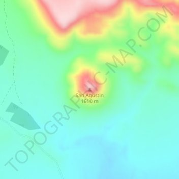
Name: San Agustin topographic map, elevation, terrain.
Location: San Agustin, Valle de Zaragoza, Chihuahua, México (27.61896 -105.81102 27.61906 -105.81092)
Average elevation: 4,780 ft
Minimum elevation: 4,557 ft
Maximum elevation: 5,341 ft
Other topographic maps
Click on a map to view its topography, its elevation and its terrain.
Valerio
México > Chihuahua > Valle de Zaragoza
Valerio, Valle de Zaragoza, Chihuahua, México
Average elevation: 5,174 ft