
l'Aleixar topographic map
Interactive map
Click on the map to display elevation.
About this map
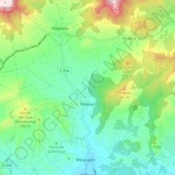
Name: l'Aleixar topographic map, elevation, terrain.
Location: l'Aleixar, Baix Camp, Tarragona, Catalonia, 43381, Spain (41.17622 1.00940 41.23804 1.09067)
Average elevation: 1,234 ft
Minimum elevation: 604 ft
Maximum elevation: 2,730 ft
Other topographic maps
Click on a map to view its topography, its elevation and its terrain.
Vandellòs i l'Hospitalet de l'Infant
Vandellòs i l'Hospitalet de l'Infant, Baix Camp, Tarragona, Catalonia, 43891, Spain
Average elevation: 922 ft