
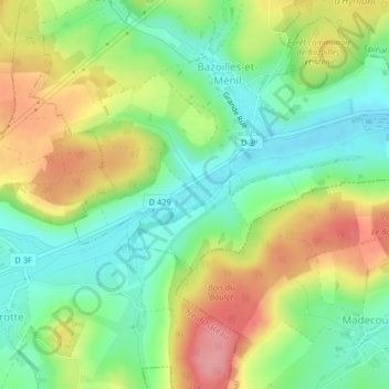
Prés de la Cure topographic map
Interactive map
Click on the map to display elevation.
About this map
Name: Prés de la Cure topographic map, elevation, terrain.
Average elevation: 1,070 ft
Minimum elevation: 919 ft
Maximum elevation: 1,276 ft
Other topographic maps
Click on a map to view its topography, its elevation and its terrain.
Le Groseiller
France > Grand Est > Bazoilles-et-Ménil
Le Groseiller, Bazoilles-et-Ménil, Neufchâteau, Vosges, Grand Est, France métropolitaine, 88500, France
Average elevation: 1,070 ft