
Pernau topographic map
Interactive map
Click on the map to display elevation.
About this map
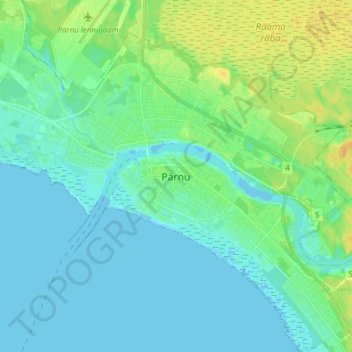
Name: Pernau topographic map, elevation, terrain.
Location: Pernau, Pärnu linn, Kreis Pernau, 80018, Estland (58.34351 24.46818 58.42351 24.54818)
Average elevation: 20 ft
Minimum elevation: -7 ft
Maximum elevation: 69 ft
Other topographic maps
Click on a map to view its topography, its elevation and its terrain.