
Massa Fermana topographic map
Interactive map
Click on the map to display elevation.
About this map
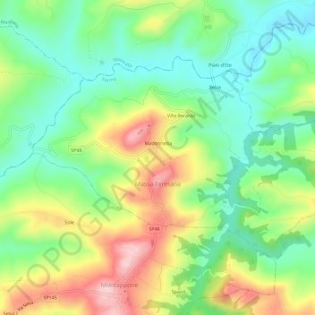
Name: Massa Fermana topographic map, elevation, terrain.
Location: Massa Fermana, Fermo, Marken, 63834, Italien (43.13981 13.45269 43.16660 13.50975)
Average elevation: 643 ft
Minimum elevation: 312 ft
Maximum elevation: 1,175 ft