
Thank you for supporting this site ❤️
Make a donation
Make a donation
Gear up for your next adventure:
As an Amazon Associate, this site earns from qualifying purchases at no extra cost to you.
Treherbert topographic map
Click on the map to display elevation.
Thank you for supporting this site ❤️
Make a donation
Make a donation
Gear up for your next adventure:
As an Amazon Associate, this site earns from qualifying purchases at no extra cost to you.
About this map
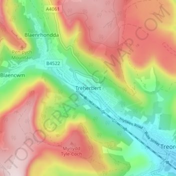
Name: Treherbert topographic map, elevation, terrain.
Location: Treherbert, Rhondda Cynon Taf, Wales, CF42 5PT, United Kingdom (51.65437 -3.55513 51.69437 -3.51513)
Average elevation: 1,132 ft
Minimum elevation: 522 ft
Maximum elevation: 1,785 ft
Thank you for supporting this site ❤️
Make a donation
Make a donation
Gear up for your next adventure:
As an Amazon Associate, this site earns from qualifying purchases at no extra cost to you.