
Pichling topographic map
Interactive map
Click on the map to display elevation.
About this map
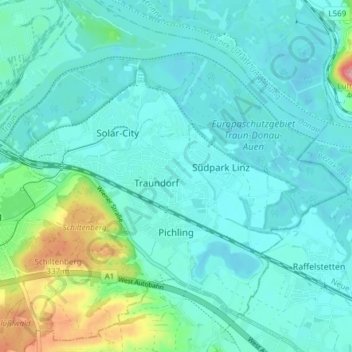
Name: Pichling topographic map, elevation, terrain.
Location: Pichling, Linz, Oberösterreich, 4032, Österreich (48.23061 14.33350 48.27055 14.40922)
Average elevation: 863 ft
Minimum elevation: 784 ft
Maximum elevation: 1,234 ft
Other topographic maps
Click on a map to view its topography, its elevation and its terrain.
Linz
Österreich > Oberösterreich > Linz > Linz
Linz, Oberösterreich, 4010, Österreich
Average elevation: 1,345 ft