
Make a donation
Gear up for your next adventure:
As an Amazon Associate, this site earns from qualifying purchases at no extra cost to you.
George Mason topographic map
Click on the map to display elevation.
Make a donation
Gear up for your next adventure:
As an Amazon Associate, this site earns from qualifying purchases at no extra cost to you.
About this map
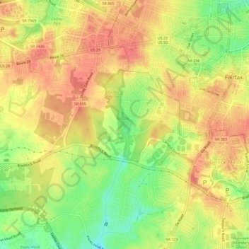
Name: George Mason topographic map, elevation, terrain.
Location: George Mason, Fairfax County, Virginia, 22030, United States (38.82393 -77.34513 38.85170 -77.28827)
Average elevation: 413 ft
Minimum elevation: 292 ft
Maximum elevation: 489 ft
Fairfax County trails, hiking, mountain biking, running and outdoor activities
Make a donation
Gear up for your next adventure:
As an Amazon Associate, this site earns from qualifying purchases at no extra cost to you.
Other topographic maps
Click on a map to view its topography, its elevation and its terrain.
Shirley Gate Park
United States > Virginia > Fairfax County > George Mason > Shirley Gate Park
Average elevation: 420 ft