
Ansan topographic map
Interactive map
Click on the map to display elevation.
About this map
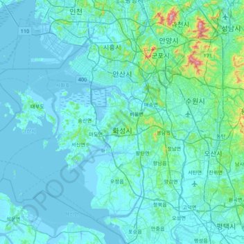
Name: Ansan topographic map, elevation, terrain.
Location: Ansan, Gyeonggi, South Korea (37.05619 126.27795 37.37688 126.93955)
Average elevation: 125 ft
Minimum elevation: -16 ft
Maximum elevation: 1,982 ft
Other topographic maps
Click on a map to view its topography, its elevation and its terrain.